Watershed Watchers

 The Watershed Watchers program is a partnership of the Santa Clara Valley Urban Runoff Pollution Prevention Program (SCVURPPP), the U.S. Fish and Wildlife Service, and the San Francisco Bay Wildlife Society.
The purpose of the Watershed Watchers program and SCVURPPP is to prevent urban runoff pollution (pollution coming from a myriad of sources, such as oils from vehicles, detergents from washing things outside, pesticides, litter, and pet waste). Because water in the Santa Clara Valley ends up flowing to the Don Edwards SF Bay National Wildlife Refuge through our watersheds, our goal is to increase the surrounding communities’ knowledge of urban runoff pollution and how to reduce its harmful effects through personal behavior.
This purpose is accomplished through many avenues, with the most popular being our interpretive and stewardship programs offered at the Environmental Education Center.

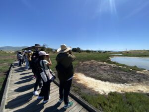
De Anza College biology students on a field trip at the Environmental Education Center. (Photo: SFBWS/Sirena Lao)
Programs we offer at the refuge include:
- Refuge tours, including birding trips
- Talks covering a variety of topics such as human history and natural history
- Volunteer events in our Butterfly Garden and nearby trails. These may include habitat restoration, litter pick-up, or trail maintenance activities that expose participants to wildlife-friendly gardening practices
- Community science programs such as BioBlitzes to help document biodiversity
- Large-scale events such as World Migratory Bird Day, Earth Day, Shark Day, and Wheels and Wildlife
- Marsh-In Summer Camp
- And more!
In addition, we host elementary, middle, and high school classes from local schools for hands-on activities as well as tours and presentations for college and university classes. Students can also participate in Habitat Restoration Service Learning Field Trips to engage in hands-on restoration work after exploring the diverse habitats at the Refuge. Activities include removing invasive plants, planting native species, and conducting trash pickups. By participating in these field trips, students not only learn about urban runoff pollution but also actively contribute to the preservation of local ecosystems.

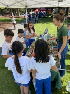
Children explore our watershed model at the City of Santa Clara Earth Day/Arbor Day Festival. (Photo: SFBWS/Sirena Lao)
We also conduct outreach to spread the message of pollution prevention and encourage visitation to the refuge to connect with nature. We participate in community festivals, table at libraries, and visit events held by schools and other environmental organizations. We also create educational posts on our Facebook and Instagram!
The Watershed Watchers program has been a vital part of the Environmental Education Center’s success, putting on great programs for the public, and giving the community opportunities to learn about urban runoff pollution and then make better choices in their everyday lives to help local wildlife and in turn, help improve their own quality of life as well.
Watching Our Watersheds
A powerful, interactive and free educational tool is now available for educators everywhere, and for visitors to the Don Edwards San Francisco Bay National Wildlife Refuge. If you’re curious about the creeks, baylands, and urban drainage networks, or would like to teach your students about the local watershed, this computer program using satellite technology may be just the tool.
Watching Our Watersheds (WOW) is a project to map the creeks, urban drainage networks, watersheds, baylands, and points of interest in Santa Clara Valley. Anyone can now download these maps and view them interactively through Google Earth.
These maps have many layers including past landscapes of the San Francisco Bay. With WOW you can compare the waterways and habitats of the late 1800s to the present-day landscape. Within the maps exist points of interest such as diaries of Forty Niners who stopped in San José on their way to and from the gold mines, lists of birds and plants from early botanists and ornithologists, and some of the earliest landscape photography taken in the state. Archives were searched for every photograph, map, and manuscript revealing aspects of the Santa Clara Valley’s former ecological landscape. Each map comes with a User’s Guide to navigating in Google Earth and answers to FAQs about the WOW project and the individual layers in the map. The maps cover western, central and southern Santa Clara County.
This interactive program allows educators to show pathways of urban runoff and teach about watershed health. Currently, the Living Wetlands program uses WOW in the classroom to locate the student’s school to show what watershed they are in, the closest water body to the school, and the type of historical habitat they are in. It is used to teach what urban runoff is and ways to reduce it. Intern Diane Luu observed that when WOW was presented in the classroom, &quo;the kid’s eyes lit up just being able to see an aerial view of their school. It really tied in everything the students had been learning about watersheds and helped create the connection of personal responsibility. Students and teachers can add their own points of interest and personalize their own watershed map.
Go to the Santa Clara Valley Water District Website and begin using this great resource!
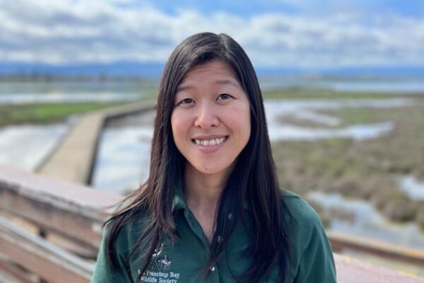
Watershed Watchers Program Coordinator
watchershedwatchers@sfbayws.org
Phone: (408) 515-1889


